Saturday, June 30, 2012

First week of July to bring rains in Central India

METD WEATHER
Akshay Deoras
Severe Weather Forecaster

Finally a little good news seems to be coming in! First we shall see the last week rainfall of June 2012


Top most is the weekly rainfall ( 21st June to 27th June 2012) and the above one is the Monsoon season rainfall from 1st June to 27th June ( data updated till 29th June).

Considering the seasonal rainfall, it can be noted that only NE India ( Sikkim) i.e Assam and Meghalaya has got excess rainfall while the majority areas are in the DEFICIENT and SCANTY ZONE. The rainfall has been normal in the Western Maharashtra,Western Karnataka and some Eastern parts of Andhra Pradesh,Odisha,Chattisgarh,Lakshadweep and A&N Islands and some parts of the NE India.

The weak monsoon current and slow onset has resulted in such a large deficiency leading to multiple problems like bad sowing of the Kharif Crops,Water storage deficiency etc.


Above- The EWP map of the Madden Julian Oscillation shows the arriving wet phase ( green shade) over India. This phase is a very weak in terms of the strength but will not be so bad and hence the rainfall is expected to increase this period. 

Meanwhile, the Indian Ocean Dipole is still towards negative neutral which will be fueling the dry phase more than the wet phase as per the IndiMo 1- so again it can be expected that the rainfall will be non normal and a bit scanty from July end period. 

Favored by the MJO Wet phase and a couple of low pressures from the Bay of Bengal soon rainfall is expected in a wide area of Central India 

On 1st July, 

Areas like Washim,Akola and vicinity will be receiving some rainfall. The rainfall is expected to be convective or thunder rains in nature. Some more parts of Central,Eastern Maharashtra also will receive rains. 

2nd July-

The rainfall is expected in the entire Maharashtra state including Nagpur,some parts of Madhya Pradesh ,Chattisgarh as well. This rainfall can be expected to be little good in terms of the sowing of the Kharif Crops in these areas ( if sowing has not been done) 

3rd July- 
The rainfall is again expected in the above areas and will be considerably good helping the seeds. The rainfall is expected in a region from Central MP,Chattisgarh,Maharashtra prominently 

4th July-

The rainfall is expected to decrease a bit in Maharashtra but will be the same almost in Chattisgarh. Isolated rainfall can be expected in many parts of Maharashtra due to the low effect. 

5th July-
Rainfall expected in Central,Northern Madhya Pradesh,Chattisgarh and areas around Chattsgarh 

SYNOPSIS-

* GOOD RAINFALL IS EXPECTED AROUND/IN NAGPUR,VIDARBHA AND SURROUNDING DISTRICTS IN MAHARASHTRA,MADHYA PRADESH FROM JULY 2 ONWARDS

* THE RAINFALL SEEMS TO BE SUFFICIENT ENOUGH ( BETTER THAN THE PREVIOUS) FOR THE SOWING OF KHARIF CROPS IN MAHARASHTRA ESPECIALLY CENTRAL INDIA

* SUCH AN EVENT OF BETTER RAINFALL MAY NOT BE POSSIBLE AGAIN TILL SOME DAYS IN JULY

* FARMERS WAITING FOR THE RAINFALL IN CENTRAL INDIA SHALL THINK OF SOWING ON 2ND JUNE OR 3RD JUNE 

Wednesday, June 27, 2012

WILL JULY 2012 RAINFALL BE SUFFICIENT FOR THE CITIZENS OF INDIA??

METD WEATHER
AKSHAY DEORAS
SEVERE WEATHER FORECASTER

WILL THE MONSOON RAINFALL REACH IN TIME TO AVOID THE WATER DEFICIENCY???


* AROUND 53.5% OF THE AVERAGE RAINFALL TILL NOW IN MAHARASHTRA THIS MONTH


* SIXTEEN DISTRICTS HAVE RECEIVED LESS THAN 50% RAINFALL IN MAHARASHTRA


* 10% WATER CUT IN MUMBAI FROM JULY 1 2012


* WATER STORAGE IN THE 366 IRRIGATION PROJECTS OF NAGPUR IS 13% ONLY (AS CONSIDERED ON 26TH JUNE 2012)


* WATER SUPPLY TO PUNE CITY LIKELY TO BE IN A GOOD SHAPE TILL 15TH JULY 2012 ONLY. 


* AGRICULTURE GETTING AFFECTED DUE TO LACK OF RAINFALL


Be it agriculture or water level situation, the SW Monsoon is continuing to horrify the citizens of many areas like interior southern India, Central India and the worst for Northern India as well including places like Gujarat etc.

The question arises that will the rainfall be sufficient atleast in the first 15 days of July 2012?

Lets discuss the expected conditions!

The Indian Ocean Dipole which is directly affecting the Indian Monsoon has reached in a very low state ( Negative neutral stage). The DMI ( Dipole Mode Index) in the week 18th June-24th June was -0.09. The DMI has been falling towards neutral and negative since the monsoon commenced in India.

        PERIOD                 DMI

20120528,20120603, 0.78
20120604,20120610, 0.17
20120611,20120617, 0.05
20120618,20120624, -0.09

The above DMI plot clearly shows how good the IOD was till 03rd June 2012 with a value of 0.78. 
A more negative DMI will mean more cooler water in the Western Arabian Sea which means a less favorable conditions for the convection and subsequent the monsoon current ( Somali Current). For a very good monsoon phase ( intensity and progress), the IOD has to be positive. 

The forecasts are indicating that the IOD will have a neutral tendency in July 2012 with the POAMA Model determining a 66.7% of likelyhood. 

Such a neutral IOD is also unfavorable for the monsoon rainfall ( ALL MONSOON RAINFALL MENTIONED IN THIS ARTICLE ARE OF THE ARABIAN SEA BRANCH). The IOD swings between the negative neutral to positive neutral many times in this phase. 

This also affects the Madden Julian Oscillation as a neutral condition will result in a very less interference of the Wet phase of the MJO and also the frequency leading to less rain conditions. 

If the POAMA model is to be believed then the rainfall scenario in India ( Excluding NE India) for July 2012 ( Atleast till Mid July) will likely continue to be the same or slightly improved .In short, this trend of IOD will not assist in much rainfall and hence July 2012 ( Atleast till Mid) may also continue to see a more or less June 2012 situation with slight improvement. The net rainfall is also expected to BE LESS THAN AVERAGE FOR MOST OF THE NATION BUT IMPROVED THAN JUNE 2012

The IOD also has some interim positive values like the one in early June 2012 but the value will be less leading to less than normal rainfall in July as well. 

The POAMA models indicate that the IOD will be at the Positive stage in Aug and Sept 2012. This can bring late monsoon month's rainfall. 

CENTRAL INDIA RAINFALL OUTLOOK FOR AGRICULTURE:


The anticipated low pressure at lower levels in the Bay of Bengal doesn't seem to be in a good shape now. The forecast models also have downgraded the likelyhood of generation of a significant low pressure region. Though a weak low pressure or the so called upper air circulation is still expected to pass through Central India. 

However, the rainfall which has earlier expected to be very heavy and highly favorable for the sowing of the Kharif Crop in the region seems to be reduced. The forecast models do indicate that there will be increased in the moisture levels from around 30th June across the region with good rainfall chance during the period and expected to be a bit significant around 2nd July. As of today, it seems that a marginal sowing can be possible around 1st July or so but the risk factor hasn't vanished. The effect shall go away after 4th July or around with aperiodic rainfall again which can make the survival of the seeds difficult. 

Thus, its a challenging situation as the July 2012 rainfall ( atleast till Mid July) doesn't look impressive for the early July 2012 sowing. If one decides to wait till July end then it will be too late!

NORTH INDIA MONSOON ONSET

North India continues to wait for the monsoon. It appears that the first few rainfall can happen around 7-10th July 2012 in the region. Till that period, the weather will be dry itself. 


Tuesday, June 26, 2012

WILL THE UPCOMING RAINFALL BE SUFFICIENT FOR AGRICULTURE IN CENTRAL INDIA?

METD WEATHER
Akshay Deoras
Severe Weather Forecaster

WILL THE UPCOMING RAINFALL BE SUFFICIENT FOR AGRICULTURE IN CENTRAL INDIA?

GFS models have been consistent in suggesting that there is a good chance of heavy rainfall which is required for Agriculture in Central India very soon. If the GFS is to be believed, a low pressure region is expected to form at the lower atmosphere stretching upto 500mb atleast. 


The above 72hr (00z,26th June Int) shows the classic 850mb cyclonic circulation across Eastern Bay of Bengal. Such anticlockwise circulations often indicate the low pressure area in this region as the air is rising significantly and the coriolis force causes such anticlockwise motion of the air. 

Further up at the 500mb level, a positive vortex system is appearing around the region. Such a vortex system is an indication of such lows and assists convection as well. 

If the forecast models are to be believed, this system will be tracking exactly westwards i.e entering Eastern India by 30th June 2012 and reaching over Central India around 1-2nd July 2012. 
As a result, the precipitation models are indicating some rainfall in this region which is expected to be heavy and more in terms of accumulation which may be helpful for agriculture. 


The above 144hr ( 1st July plot) showing good amounts of rainfall in Central India i.e Eastern,Central Maharashtra,Southern Madhya Pradesh,Chattisgarh and SE of Chattisgarh. The rainfall also seems to be heavy at NE Karnataka,NW Andhra Pradesh as well. 


Above- Nagpur meteogram forecast showing a very good moisture and rainfall. One can also see the drop in the air pressure, (4th coloumn from the top) indicating the likely hood of the low

The big question is that whether this rainfall will materialize and be sufficient for agriculture activity like sowing of the Kharif Crop
The sowing has been 50% in Maharashtra till now and it has been less across Vidarbha and surroundings. 

So if this low materializes, it seems to be favorable for the sowing of Kharif Crops in the mentioned areas. 

WHICH KHARIF CROP TO SOW?

TUR,MUNG or SOYABEAN???

The question is very important as choosing the right crop now will lead to a better farming this year. 
Sowing till 30th June is definitely an act of stupidity as it will not be fruitful. Some areas do receive evening thunderstorm showers which aren't much for the agriculture and are very much deceptive. A farmer generally thinks that the monsoon has arrived but it hasn't and from the next day, the weather opens up. 

As per Rajeshbhai Kapadia of Vagaries of the Weather,-

Rajeshbhai  who is one of the best weather forecasters of India having an agricultural background informed METD WEATHER. He said that Tur is not advisable now because it takes a lot of time ( around 5 month crop). Tur requires heavy rains after regular periods of 5 days or so. If the rainfall picks up in July, one can't assure the rains in Oct period! So its not worth to sow tur now! 

On the other hand. Mung and Soyabean are much better. Soyabean requires heavy rainfall during sowing and then a rainfall of around 15mm or near is required atleast once in 5 days. Its a short period crop ( around 2-3 months). Mung also needs similar lesser rainfall atleast once in 4 days or so. Its also a short time crop and after the conditions come together for the sowing, you can go for Mung and Soyabean. Going for tur is definitely not advisable. 


Friday, June 22, 2012

DEFICIENT MONSOON AFFECTS KHARIF SOWING. HEAVY RAINS LIKELY IN EAST,NORTH EAST INDIA

METD WEATHER
AKSHAY DEORAS
SEVERE WEATHER FORECASTER


The Indian Summer Monsoon which has become a headache for the farmers and weather forecasters this year has given another shock. The datas from the NCEP for Southern India are indicating deficient rainfall across the Southern India.

The data updated till 20th June 2012 for a period of past 30 days is as follows

STATION                          PERIOD TOTAL RAIN(mm)                     ANOMALY(mm)

BOMBAY                            141.4                                                            -132.4
(SANTACRUZ)

PUNE                                   26.8                                                              - 89.5


GOA                                     816                                                              +191.9

MANGALORE                   622.1                                                            -172.8

COCHIN                             285.6                                                            - 303.1


TRIVANDRUM                  94                                                                 - 212.9


CHENNAI                           3.5                                                               - 61.1


BANGALORE                   8.9                                                                - 109.9


NAGPUR                          125.3                                                             + 24

KOLKATA                       86.4                                                               - 167

TEZPUR ( ASSAM)        451.1                                                             + 160.8

GUWAHATI                   417.4                                                              + 148.4


WHAT DOES ONE INFER?

Looking at this 30-day rainfall pattern for those areas where the Monsoon has reached, its very clear that the Bay of Bengal branch is more active than the Arabian Sea branch. Though all the station's data hasn't been considered, the prominent datas are sufficient to draw the conclusion.

The strange monsoon onset pattern of this year even didn't help the Western Coast. I was expecting that the Western Coasts will be getting excess of rainfall as compared to the interiors but the Western coasts ( Except Goa) are also witnessing deficient monsoon conditions.

Even Minicoy,Laccadive ( Lakshadweep Is.) has got 243.5mm rainfall which is 37.9mm deficient.

I do blame the Negative ( Neutral IOD) Indian Ocean Dipole to be directly responsible. The 2012 IndiMO 1 presented by METD WEATHER showed a direct relation of the MJO and IOD.
The Somali Current or the monsoon winds aren't strong to bring heavy rains in these region and also in the interior parts of India like interior Southern India such as Bangalore,Cochin and Southern parts like Trivandrum etc.

Chennai has got only 3.5mm rains ( 2.4mm) at the airport. Cochin also has recorded more than 300mm less rains.

On the other hand, Central India has got a bit surplus rainfall. Its all due to the recent low pressure influence which is also reducing now.

North-East India has got very good rainfall this season till now.

WHATS NEXT??

The GFS 12z,22nd June shows the low pressure region at 850mb across the Eastern India. 


This low pressure region will be bringing heavy rains in Eastern India especially ACROSS THE NORTH EASTERN STATES LIKE ASSAM,MEGHALAYA till 27th June 2012. 


Flooding conditions can be expected again in Assam so people must be careful in this region. 


Meanwhile, the mentioned break monsoon situation is now all set to appear in India ( excluding East and North East India). Rainfall amount and cloud cover shall be going down in Central India,Southern India ( some parts of Western India) also while North India continues to wait for the Monsoon.


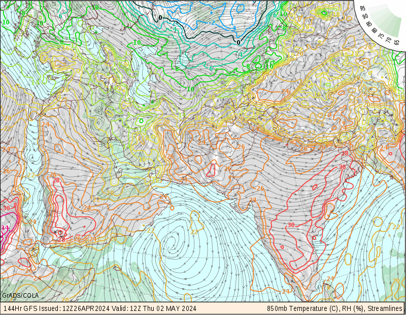
Here is the 850mb moisture map of GFS 12z,22nd June valid till 144hr i.e 28th June 2012. One can see how significantly less is the moisture over India ( excluding the western coast).

The 12z runs do indicate some less moisture but anything like the one being indicated seems likely and hence the break monsoon situation will happen.

Temperature rise is expected in Central India due to absence of cloud cover

KHARIF CROP SOWING CRISIS CONTINUES


COURTESY- THE HINDU BUSINESS LINE

Due to deficient rainfall, the kharif crop sowing crisis still continues in India as the necessary rainfall for the sowing isn't there. Planting of paddy crops is delayed in the states like Karnataka,Andhra Pradesh,TN,Assam etc.

Here is a wonderful news report of it-

http://www.thehindubusinessline.com/industry-and-economy/agri-biz/article3559490.ece

Only 50% area has been sown in Maharashtra.

VOTING FOR THE YOUNG ACHIEVERS AWARD 2012 CONTINUES


I am thankful to those you have voted for me in the 2012 Young Achievers Award presented by Lokmat group. 


I have been nominated in the Education field for this award considering my work. The award will be given on the basis of public voting. 


If the readers/fans of METD WEATHER wish to vote me, they can do so by the way of SMS


*** TO VOTE**


TYPE THE FOLLOWING IN THE SMS SECTION


LOKMAT EDU03


AND SEND THE SMS TO 


54242. 


- THE FORMAT IS EDU 03 ( ZERO THREE) WHICH IS MY CODE-


The voting will be continuing on 23rd June 2012 also....


STAY TUNED FOR UPDATES


Thursday, June 21, 2012

Active Low pressure brings rainfall in Central India.


METD WEATHER
AKSHAY DEORAS
SEVERE WEATHER FORECASTER

21st June 2012,
1130PM IST
Nagpur-

Rainfall continued almost for the entire day in Central India including Nagpur. The rainfall was very heavy towards the Chattisgarh region. As was mentioned in the earlier posts, the low pressure region at the lower atmospheric profiles currently somewhere NW of Jharkhand-MP region was responsible for the increased moisture in the region causing the rainfall which has been non convective in the Maharashtra side. The Monsoon current or the Somali Current continues to remain weak considering the IOD DMI of around 0.05.

The GFS models continue to indicate that the surface low pressure will be moving NW and fizzing out as it cuts off from the 850mb low over Eastern India. As this activity happens, there will be a decrease in the rainfall in Central India though mostly cloudy weather can be expected on Friday considering the low position.


The break monsoon situation seems to be likely for the Central India starting from around 24th June or so.

----------------------------------------------------

Rest of India-


Heavy rainfall shall continue in the Eastern parts adjoining Maharashtra atleast on 22nd June. Though the rainfall rate can be low but the rainfall accumulation seems to be very good. Northern India is still continuing to wait for the monsoon. The maximum temperature in New Delhi today was 43C with dry winds likely to be blowing in the Northern India.
The monsoon seems to be progressing there in July itself and hence I shall not be changing the previous forecasts for the region regarding the monsoon onset including Sindh region.

IMD has advanced the Northern Limits of the monsoon today. The Northern limits as per them covers Eastern Uttar Pradesh,Eastern Madhya Pradesh also.

The break monsoon situation for the interior parts of India,Central India is very likely from around 25-26th June 2012.

In the Western India, rainfall was less today. The weather in these areas can be expected to remain almost the same with much of high heat indices leading to a bit uncomfortable conditions.

----------------------------------------------------

METD WEATHER MONSOON ONSET NORTHERN LIMITS

The last update on the METD WEATHER monsoon onsets was of Mumbai region. The next major advancement was expected to be of Nagpur and Central India on/by 19th June 2012. However as the conditions required weren't satisfied, the monsoon onset wasn't considered. The irregular rainfall pattern ( all convective) in Central India even were not favorable for the onset.

Though all the parameters required for the declaration of the monsoon till Central Madhya Pradesh are getting satisfied, the break monsoon situation seems to be a worrying factor. Nevertheless, the rainfall activity in this region will be measured and monitored on 22nd June and any major decision ( if any) regarding the further advancement of the monsoon shall be taken on Saturday,23rd June 2012 keeping in mind the 48hr parameters pattern.

----------------------------------------------------------------------------------------------------------------------------------

NOMINATED FOR THE "YOUNG ACHIEVERS AWARD 2012" BY LOKMAT GROUP


I have been nominated for the "Young Achievers Award 2012" of the Lokmat Group. The nomination was done by Prof.Y.B.Katpatal of VNIT,Nagpur and Mr.Deepak Kulkarni. The Young Achievers Award is to felicitate the students who are doing something extra in their life like I am running METD WEATHER,AKG and much more.....

I have been nominated in the Education category and the results are likely on the basis of Public voting.

THE READERS/FANS OF METD WEATHER AND AKG CAN VOTE ME IF THEY WISH. HERE IS THE INSTRUCTION BELOW FOR THE VOTING


1) THE VOTING IS LIKELY TO BE OPEN TILL 24TH JUNE 2012

2) ONLY THOSE USING INDIAN MOBILE NETWORK OPERATORS CAN VOTE

3) TO VOTE- 

TYPE - 

LOKMAT EDU03

AND SEND THE SMS 

TO 

54242 


3) YOU WILL GET AN SMS THANKING FOR THE VOTE


FORMAT IS 
LOKMAT EDU03 

WHERE EDU03 IS MY CODE. 

Sunday, June 17, 2012

Will SW Monsoon reach Central India on time?

METD WEATHER
AKSHAY DEORAS
SEVERE WEATHER FORECASTER

In the IndiMO II, METD WEATHER had issued 19th June 2012 as the monsoon onset date for Nagpur and a general of 14th-19th June 2012 for the Central India. The monsoon however as mentioned in the previous posts is very slow and almost stalled which is making this decision difficult

METD WEATHER CONDITIONS for Monsoon onset--


1] MONSOON
A) - HEAVY RAINS
THE MONSOON RAINFALL OR THE ONSET OF MONSOON IS CONSIDERED ON THAT DAY WHEN THERE ARE HEAVY RAINS ( *** NOT APPLICABLE FOR RAINFALL DUE TO ANY CYCLONE LANDFALL***). 
RAINFALL ACCUMULATION MUST BE MORE THAN 5mm

*** CONVECTIVE RAIN AFTER SUNNY MORNING SHALL NOT BE CONSIDERED AS MONSOON RAINS***

B)- WINDS
THE WINDS ( SURFACE-500MB) MUST BE FROM SOUTH-WEST ATLEAST FOR 48HRS AND HAVING INTENSITY OF MORE THAN 10KT IN ALL LEVEL. 
( WINDS FROM SOUTHWEST FOR A DAY ARE NOT TO BE CONSIDERED AS MONSOON WINDS) 

C) MOISTURE
***SURFACE RELATIVE HUMIDITY MUST BE GREATER THAN 60% ATLEAST FOR 48HRS 
*** THERE MUST BE A DEEP LAYER MOISTURE IN ATMOSPHERE IN LAYERS 500MB-900MB ATLEAST FOR 48HRS WITH SATURATION ***

D) AIR PRESSURE
*** SURFACE AIR PRESSURE IN A REGION ( NOT APPLICABLE FOR HILLY REGION) SHALL BE BELOW 1006 MB CONSECUTIVELY FOR 2-3 DAYS. SINCE LESS PRESSURE REGION INDICATES LOCALITY OF THE MONSOON TROUGH. 
*** ANY PERIOD WHEN SURFACE AIR PRESSURE GOES ABOVE THE LIMIT SHALL NOT BE CONSIDERED FOR MONSOON ONSET*** 

E) TEMPERATURE
*** SURFACE AIR TEMPERATURE MUST DROP TO 35C OR BELOW AFTER PRECIPITATION
*** TEMPERATURE SHALL BE MAINTAINED IN THE MAXIMUM LIMIT AS 35C ( MAX TEMP) ATLEAST FOR 48-72HRS. 
*** TEMPERATURE ABOVE THE LIMIT SHALL NOT BE CONSIDERED FOR MONSOON ONSET***

F) CLOUDING
*** DUE TO DEEP LAYER MOISTURE,CLOUDING SHALL BE PRESENT IN THE REGION 
*** OVERCAST CONDITION ATLEAST FOR 24HRS CONTINUOUSLY
ANY CLEAR WEATHER DAY WITH ALL THE ABOVE CONDITION POSITIVE ( EXCLUDING RAINFALL) SHALL NOT BE CONSIDERED FOR MONSOON ONSET

G) 850MB MOISTURE TRACK FOR NORTHERN LIMITS OF MONSOON
THE NORTHERN LIMITS OF MONSOON SHALL BE ADVANCED ONLY WHEN 850MB MAP SHOWS MOISTURE OF RELATIVE HUMIDITY GREATER THAN 60% AND BEING MAINTAINED FOR 2-3 DAYS


THE ABOVE ARE THE CONDITIONS WHICH METD WEATHER HAS BEEN CONSIDERING SINCE LAST 3 YEARS AND REGARD AS THE CORRECT MEASURES TO DETERMINE MONSOON ONSET. 

THE INDIAN METEOROLOGICAL DEPT NORMS ARE DIFFERENT AND HAVE NO CONNECTION TO THE DATES FORECASTED BY METD WEATHER 


Present conditions in Central India-

1) Rains ( IMD Nagpur)


As can be seen from the rainfall on 16th June evening till 1000hrs of 17th June, Jabalpur in M.P has got the heaviest rainfall of 75.7mm followed by Chadrapur in Maharashtra of 44mm and Nagpur getting 11.8mm rainfall. 

Still heavy rains weren't reported for more than half of the stations above. 

2) Winds-
The peak winds in Nagpur since 16th June were around 20km/hr mostly from West. The upper air winds also are satisfying the conditions. 

3) Moisture- 
The Surface Relative Humidity (lowest) was 35% at Nagpur at 0530PM on 16th June. This definitely doesn't fit into the criteria of the monsoon onset.

4) Air Pressure at the surface
The mean air pressure was around 1002mb since 16th May. The pressure is being maintained since 24hrs. 

5) Clouding- 
The overall cloud cover falls in the Mostly Cloudy with today being the same in Nagpur. 

6) SFC temperature
The surface air temp of Nagpur on 16th June was around 38.2C which violates the norms

The 850mb shows some moisture in the region. 

If these conditions ( except temp,moisture) are favorable then why isn't METD WEATHER declaring the onset???

Here is the latest (00z,17th June) GFS Nagpur Meteogram. The topmost profile shows the atmospheric moisture till 25th June. As can be seen that the amount of moisture in the region is strongly decreasing from around 18th-19th June. The 2m RH plot also shows a strong decrease in the moisture amounts with absolutely no rainfall expected from 20th June onwards. 

If METD WEATHER declares the onset of Monsoon in the region then the immediate dry phase will take over with no rains. The parameters also aren't expected to remain consistent as a result the change of monsoon onset on 19th June is very low...... 

Abhijit Modak from Badlapur city,Maharashtra sends these photos taken today (17th June 2012). Badlapur is an Extended Central Line Suburb of Mumbai in Thane District.  . These photos clearly show the heavy rains in the region.  


Friday, June 15, 2012

Break Monsoon conditions likely. Significant effect on Kharif Crops expected

METD WEATHER
Akshay Deoras
Severe Weather Forecaster

The Indian Summer Monsoon particularly the Arabian Sea branch still continues its stalled approach this year. The extended GFS forecast ( consistent runs ) are indicating decreasing moisture content at the lower atmospheric profiles esp at the 850mb


Above- the 144hr GFS ( 12z,15th June Int) of 20th June shows "Nearly SAME" moisture levels across India ( Except North East India). This is a classical situation which depicts the weak monsoon winds or the Somali Current. As the current travels from the West,South-West and is of less intensity, it can't survive the interiors and hence the moisture deposition always remain higher for the Western Coast and relatively drier in the Central and interior regions. While the Bay of Bengal Branch continues to be doing good.

Negative Indian Ocean Dipole ( Slightly Neutral) and Dry Madden Julian Oscillation (MJO) responsible- 


CORRECTION- THE DMI VALUE TILL 10TH JUNE ( FROM 4TH JUNE 2012) IS +0.17 AND NOT +0.57 AS WAS PREVIOUSLY MENTIONED. 


           DATE              DMI

20120521,20120527,0.55
20120528,20120603,0.78
20120604,20120610,0.17

As can be seen from the above DMI indices, the IOD was much positive during end of May till 3rd June which caused a robust advance of the monsoon in someparts of India like Anadaman and Nicobar Is,North East India but in the week ending at 10th June, the DMI has fall down to 0.17. 

A positive DMI or Indian Ocean Dipole means warmer than normal sea surface temperature in the Western Indian Ocean ( Arabian Sea) than the Eastern which fuels the MJO ( which turns wet phase) and brings more rains in India. The slow and stalled monsoon is just due to this reason..

Above- The MJO EWP models showing a very significant dry phase over India ( As of 15th June) indicated by the pinkish shade region near the Southern Bay of Bengal. These are the two primary reasons causing the monsoon to be weak. 

Central India rainfall -


The above IR imagery of India of 1730z ( UTC) of 16th June shows good clouding across Central India with some convective signatures. Widespread Rainfall (Convective)  happened today in Nagpur during the evening hours. Though METD WEATHER didn't record the data but the rainfall accumulation seems near to 10mm at the Headquarters. This increased rainfall activity/clouding is due to an upsurge in the moisture in this area formed due to the movement of an upper level low form the East. The moisture will be reducing within 48hrs. 

The atmospheric stability evidently seems to be less on 16th June in Nagpur for strong convection. 
As the moisture contents decrease, the weather is expected to open up with the decrease in the rainfall ( Break Monsoon conditions). 

North East India shall continue to get good rainfall meanwhile ( Projected till 144hr from 12z,15th June)

50% LESS RAINFALL IN THE SECOND WEEK OF JUNE

The rainfall amounts have been almost 50% less in a period June 7-13. The nationwide rainfall recorded was around 15.3mm as against the 30.6mm which IMD consideres average. The slow monsoon also has delayed the Kharif Crop sowing. 

If the GFS is to be believed, the monsoon still will not be strong in June for all the states ( excluding North East India) so conditions required for the sowing of Kharif Crop like good rains ( continuous) for some days will not be available. 

In Central India also the rainfall amounts will decrease considerably from 18-19th June ( Average) which will make the sowing difficult. Thus the agriculture and subsequent economy seems to be getting a blow this month. 

The North India also continues to wait for the monsoon and continues to heat up. Allahabad recorded consistently over 45C today i.e a temperature of about 46C,Delhi 43C.....

Atleast till 27th June, I don't see any monsoon movement in the Northern parts of the nation so it appears that it will take July for the monsoon to reach there. 

FLOODING POTENTIALS IN ASSAM

As per the news reports, around 50,000 people have been affected in Assam due to constant heavy rains leading to a rise in the water level of River Brahmaputra. The water-level of the Brahmaputra was rising at Dibrugarh, Nimatighat in Jorhat, Tezpur and Dhubri, while its tributaries Buridihing, Subansiri, Dikhow, Dhansiri, Jia Bharali and Kopili were also maintaining a steady rise.
The flood affected districts include Lakhimpur, Dhemaji, Dibrugarh, Kamrup (Rural), Baksa, Udalguri, Sonitpur, Nagaon and Dhubri along with Hailakandi in the Barak Valley.
Nearly 50,000 people have been affected by the current wave of floods, while road communication was affected in many part of these districts, they said .
The worst affected areas are Naoboicha and Narayanpur revenue circles in Lakhimpur, Jonai, Dhemaji and Sissibargaon circles in Dhemaji, Gohpur in Sonitpur, Algapur in Hailakandi, Goreswar, Salbari and areas adjoining Bhutan in Baksa districts, the sources added.

Rainfall activity seems to be high for this region which can elevate the flooding potentials.... 

Thursday, June 14, 2012

STALLED Monsoon in India

METD WEATHER
AKSHAY DEORAS
SEVERE WEATHER FORECASTER

The Indian Summer Monsoon marked timings as per the METD WEATHER IndiMO but not 100%.... As was expected,the monsoon is very much passive in June and the progress is very slow.


The latest IMD Monsoon Advance map shows the slow movement feature.Also the low pressure area formed in the Arabian Sea in the late May into June deflected the winds and made much from the west due to which the monsoon movement this year is much more rapid and northwards along the Western Coast as compared to the Southern India. The Bay of Bengal branch is progressing very well.


The so called monsoon current or the Somali current is also weak right now with the dry phase of the Madden Julian Oscillation in progress. As was mentioned in the IndiMO I, the MJO is directly associated with the IOD ( Indian Ocean Dipole). When the IOD is positive, enhanced wet phase of the MJO happens which brings more rainfall across India and boosts the monsoon as well.

As seen from this observed and estimated DMI ( Dipole Mode Index), the IOD for May end to June is much towards the negative or neutral. The last week value was +0.17 which is the neutral. As the IOD is turning to neutral, I do estimate that the intensity of the dry and the west phase will be equal now as against the high intensity of the dry phase during the negative event which was happening now. The DMI forecast do confirm that the DMI will turn to the positive side in the July-August period which one can consider favorable for the monsoon rainfall.

Whats next????


As can be seen from the 144hr 850mb GFS, there is much improvement in the moisture for the western belt only which starts from Southern India. Parts like Central India, Eastern parts of Central Southern India will still be deficient in terms of the moisture which includes many cities like Chennai,Bangalore,Hyderabad,Nagpur etc..

This clarifies that the Monsoon IS LIKELY TO BE DELAYED IN THE CENTRAL INDIA AND
SUBSEQUENTLY IN THE NORTHERN INDIA,SINDH AREAS ALSO.
THE INTERIOR SOUTHERN INDIA ALSO WILL EXPERIENCE DEFICIENT RAINS WHICH CAN BE TILL 20TH JUNE ATLEAST.

THE SW MONSOON WHICH EARLIER WAS EXPECTED TO REACH NAGPUR BY 19TH JUNE 2012 WILL BE DELAYED THIS YEAR THOUGH THE 850MB MOISTURE REACHES. THE RAINFALL ACTIVITY ( HEAVY RAIN) WHICH IS A METD WEATHER MONSOON ONSET NORM SEEMS TO BE VIOLATED ON 19TH JUNE.

OVERALL, THE CONDITIONS WILL IMPROVE IN JULY AND AUGUST...