Monday, March 26, 2012

ENSO ( El Nino Southern Oscillation) update


METD WEATHER
AKSHAY DEORAS
SEVERE WEATHER FORECASTER

After the recent continuous updates on The Superstorm or Dust Storm in Asia, its time to update the people with something new. The aspect of ENSO or El Nino Southern Oscillation is an old phenomena but less known to the people. In this article, I shall not go much into depth on technical aspects of what ENSO means and other aspects like El Nino or La Nina. There are some articles already which can be accessed by the readers by searching on this page.


The above is a Unisys prepared image comprising of Sea Surface Temperature across oceans of the world. Majority of the people will face problems in reading this so I shall describe it.

You can identify the physical map's continents and countries. Also the oceanic region can be identified easily. Here you see combination of colors in the ocean ( light blue,dark blue,light green,dark green,yellow,purple). What are these???

Its simple, just see the image left portion. There is a scale. The scale represents Sea Surface Temperatures (SST) anomalies in degree celsius. Anomaly refers to the abnormal ( greater or less) than the normal SST present at this time.

The bluer shade beginning from dark blue indicates cooler than normal SST in decreasing process. The light blue,green colors indicate nearly normal or slightly normal anomalies ( 0.5C to 2C). Higher colors like Yellow or Red indicate above normal (around +5C) sea surface temperature.

What to look in such maps-
The main region to look for is the Pacific Ocean prominently the areas in Central Pacific Ocean around the equator. The below region shows the division of Equatorial Central Pacific in regions known as Nino with their corresponding numbers. These regions ultimately determine whether a La Nina or El Nino is going on..


And its simple now!

One can clearly see lots of blues in the eq central pacific ocean which indicates the ongoing La Nina. The recent update from Climate Prediction Center shows ( Latest Week)


Region    Temp anomaly

Niño 4       -0.4ºC 
Niño 3.4    -0.5ºC
Niño 3       -0.1ºC
Niño 1+2    0.5ºC


We just see the past datas or the SST during last week when 2012 Summer Forecast for India was released..

NINO 4:        -0.8C
NINO3.4:      -0.6C
NINO 3:        -0.2C
NINO 1+2:     0.4C


Having compared the week variation, one clearly implies that temperatures are rising in Pacific ( EXCEPT Nino 4 region) 


26th Feb and 25th March 2012 SST comparison-


On comparing the SST for Equatorial Pacific, its being observed that the overall volume of cooler SST has increased since Feb 2012! The volume of warmer SST around South America also has decreased!


The above image shall clarify! There has been cooling in the region of RED OVAL as compared to Feb 2012 SST.
Note- The above image is of Mar 2012

Areas in pink show less warm SST.

Forecast-
Looking at the overall 1-month analysis, it appears that ENSO is turning to Neutral Stage but in a slow manner. The overall transition is expected into late April ( CPC) but METD WEATHER suggests things to delay. It may appear that the ENSO neutral shall appear by May mid or end depending on the decay rate!

The Wind anomalies at lower and upper level of atmosphere still indicate the persisting La Nina!

STAY TUNED for UPDATES

Thursday, March 22, 2012

DUST IMPACTING INDIA BADLY,SCENARIO NOT TO CHANGE FOR 24HRS

METD WEATHER
AKSHAY DEORAS
SEVERE WEATHER FORECASTER

*** MINOR IMPROVEMENT IN THE OVERALL CONDITIONS IN INDIA***
*** DUST STILL SETTLED OVER GUJARAT,RAJASTHAN,CENTRAL INDIA,NORTH INDIA
*** MIDDLE EAST CONDITIONS IMPROVING***
*** CONDITIONS NEARLY NORMAL IN SINDH AND OTHER PARTS OF PAKISTAN***


The Superstorm which originated on 17th March and sent plumes of dust towards Indian Sub continent is still maintaining its strength but has weakened a bit thus improving overall visibility over India.
Morning datas indicate that the visibility is still less in much of India. Most of the areas still have "Widespread Dust" present. 


The above surface weather analysis shows the presence of three low pressures over India. The added dust over Saudi Arabia is still arriving in the form of dust plumes. The below color enhanced imagery clearly indicates a stronger plume over the lower Arabian Sea...


The above Color Enhanced imagery indicates a persisting dust plume at central arabian sea. The dust plume is entering India from the Western India mainly across Maharashtra-Goa border. At the same time, a persisting low pressure over South-Western Saudi Arabia is pulling the sand from Oman,South-Eastern Saudi Arabia which is generating the visible dust plume. So the area comprising of Western India,Central India and some parts of North India shall have a continued widespread dust in the atmosphere. 


The upper air jet stream is expected to amplify and arrive over Oman region by 25th March. This upper level jet shall boost or enhance the upper air wind speed and can help in a bit clearing of the dust. More on that shall be notified later


Forecasts-


Nearly normal conditions with highly reduced suspended dust particles will return from 24th March across the middle east. At the same time parts of Saudi Arabia and Oman will get some widespread dust but improving visibility conditions from today onwards. Across Sindh, conditions shall return to normal from 24th onwards with improved visibility and very less suspended particles

Across India, slight improvement in the conditions are expected but the scenario won't change much till 24th March. The forecasted dust shall continue to maintain the levels and hence we expect the scenario to be similar.


STAY TUNED FOR UPDATES

Wednesday, March 21, 2012

DUST ENTERS NAGPUR,MAINTAINS INTENSITY IN INDIA

METD WEATHER
AKSHAY DEORAS
SEVERE WEATHER FORECASTER

***WIDESPREAD DUST ARRIVES IN NAGPUR*****
***VISIBILITY DIPS TO 1.5KM FROM 6KM IN JUST FEW HOURS***
***INTENSITY MAINTAINED IN MOST OF THE PART OF INDIA***


*** CONDITIONS IMPROVING FURTHER IN THE MIDDLE EAST***


***** RAW ESTIMATES SUGGEST THAT THE DUST HAS SPREAD IN THE ENTIRE INDIA INCLUDING SOUTHERN INDIA******


MAJOR SCENARIO UNFURLING NOW*******


Above- Mr.Sampath Iyengar from Mumbai sends the above photos taken on 21st March 2012 from Lokhandwala area Mumbai. 


Above- I took some photos of the Dust covered streets of Nagpur,India today at around 1030PM IST. The visibility is continuously at 1.5km since early morning with " Haze" conditions..


THE HISTORIC SUPERSTORM SENT DUST WHICH HAS GRIPPED WESTERN,NORTHERN,CENTRAL INDIA ENTERED IN NAGPUR TODAY MORNING. 
THIS WAS CONFIRMED BY THE VISUAL OBSERVATIONS AND THE VISIBILITY PARAMETERS PRESENT AT THE AIRPORT WHICH SHOWED A SHARP DIP AS FOLLOWS-  


ABOVE-  THE WUNDERGROUND DATA OF NAGPUR AIRPORT SHOWS A DIP IN THE VISIBILITY FROM 0310AM TODAY WITH HAZE CONDITIONS. THE PRESENT VISIBILITY IS AROUND 1.5KM HERE

HOWEVER, THE CONDITIONS HERE ARE NOT AS SEVERE AS THEY WERE IN MUMABI OR OTHER AREAS TILL NOW BUT WITH THE INCREASING PERIOD, I DO EXPECT THE VISIBILITY TO DIP FURTHER IN THE AFTERNOON PERIOD

PEOPLE DRIVING VEHICLES MUST WATCH OUT FOR LOW VISIBILITY ESPECIALLY IN CENTRAL INDIA***********


DUST SPREADS IN INDIA!

AS SEEN FROM THE ABOVE VISIBLE SATELLITE IMAGERY, THE ENTIRE INDIA ALMOST IS COVERED UNDER THE DUST. THE MORE IMPACTS ARE IN CENTRAL INDIA AND RAJASTHAN. 


NOTE- ANALYSIS OF THE ACTIVITIES FROM MIDDLE EAST SHALL COME SOON AS ITS DARK THERE AROUND MAKING IT IMPOSSIBLE FOR VISIBLE IMAGERY TO APPEAR


DUST STORM MAINTAINS STRENGTH IN INDIA, NEW PLUMES VISIBLE IN NORTH AFRICA

METD WEATHER
AKSHAY DEORAS
SEVERE WEATHER FORECASTER

*** WIDESPREAD DUST CONTINUES IN INDIA*****


*** REPORTS FROM MULTIPLE AREAS STILL INDICATING THE PRESENCE OF WIDESPREAD DUST***


*** NEW DUST PLUMES VISIBLE OVER NORTH-AFRICA***


THE SAND BLOWING TOWARDS INDIA AS ON 20TH MARCH 2012
COURTESY-NASA MODIS


THE HISTORICAL DUST STORM/SUPERSTORM HAS IMPACTED THE CITIES OF INDIA ON A VERY LARGE SCALE. THE WIDESPREAD DUST HAS CONTINUED TO REMAIN IN MANY AREAS LIKE GUJARAT,RAJASTHAN,PUNJAB,BHOPAL,OTHER PARTS OF MADHYA PRADESH,MUMBAI ALSO.


Above- Mr.Kanishka Raj Rathore from Bhopal,Madhya Pradesh sends the photo to METD WEATHER. The photo is of Bhopal City in Central India and taken at 1240PM IST. 


Realtime Conditions and Forecasts- 


Right now, conditions are further improving across the Gulf countries. Today's reports show lesser reports of Blowing Sand or Widespread Dust across the areas such as UAE,Saudi Arabia,Oman and vicinity. Visibility is further improving as was estimated for the regions. However minor suspended dust particles are still going to be present in the atmosphere atleast on 22nd March also where majority of clearing is expected


Conditions are highly improving across Sindh and other parts of Pakistan. Some areas today got very good visibility and lesser suspended dust particles! 


In India, Widespread Dust also is being reported. Reports from Gujarat like Rajkot,Ahmedabad still indicate presence of Widespread Dust or Blowing Sand with very low moisture and RH over 5% at minimum. The visibility has improved a bit in Rajkot since afternoon but people are informing that still dust is occupying on their cars etc.. 


Reports from Central India particularly Bhopal are impressive for Widespread Dust and VERY LOW VISIBILITY 1km in the area
The moisture has significantly dropped today due to the persisting dust. 


In Amritsar, BLOWING SAND continued today also in the afternoon period.. 


In Mumbai,Our fellow friend Rajeshbhai Kapadia of Vagaries of Weather (rajesh26.blogspot.com) mentioned visibility dropping to 900m at 0230PM


Forecasts-


To begin with, There appears another Dust Plume over North-Eastern Africa i.e Egypt and vicinity. 


The above imagery of Visible Spectrum clearly shows New Dust Plume over North-Eastern Africa. The area is around Egypt.After cross checking with the weather stations of Egypt, its clear that there has been some Dust Activity around Asyut,Egypt this afternoon. Blowing Sand was reported in fact at that location. There has been NO REPORT of any Dust activity in that area


My estimates do suggests that the suspected region is DUST. The Infrared Spectrum shows no reflection from the region which normally clouds do. This area is being watched by METD WEATHER and Vagaries of Weather closely. 
Any updates shall follow soon!


On comparison of the two images, its a clear thing that other clouds are being seen as it is in the Infrared spectrum except that region-


alanlysis chart


The above Surface Weather analysis from Kuwait Weather Dept. shows the moving Low Pressure "L" over Southern Saudi Arabia with the cold front trailing behind.


If this holds true, we can expect the dust plume to slowly enter or move towards Iraq,Saudi Arabia areas on 22nd March 2012. The persisting Low pressure and Jet streams shall help in doing so

If this comes true, Weather shall again turn Dusy in Iraq,Saudi Arabia,UAE,Qatar etc.. and likely in Oman on 22nd March 2012 which will entirely depend whether my estimates are true or not. However an eye must be kept on the event happening no matter if it doesn't happen

Sindh-
Conditions shall improve further in next 12-24hrs with lesser suspended air particles in the region.

India-
Conditions are now expected to improve slowly in Gujarat,Rajasthan,Central India,Northern India. Though Nagpur didn't receive any dust which was being expected but still the northerly or westerly winds can advance some dust tomorrow so the possibility can't be RULED OUT

Mumbai- Things will turn to normal from tomorrow as the dust shall not cause any effect tomorrow!

DUST COVERED MUMBAI!!!!!!!!!!!


KELLI CLOGSTON THEXTON from Mumbai sends this wonderful photo taken from the expressway in Mumbai at 0430PM today. 


Kelli's location was here on the Western Expressway


http://maps.google.co.in/?ll=19.042992%2C72.831974&spn=0.011663%2C0.01929&hnear=Mumbai%2C+Maharashtra&t=h&z=16


i.e on the express way. Kelli writes- 


This is taken from the Western Expressway. You should normally see the Worli Sealink and high rises across the bay!. 


 It was taken at 4:30 p.m. on March 21. The "ridge" you see just above the sea wall is about 1 football field away. It is probably .25 miles across the bay and it is shocking that you can't even see the high rises or the sea link!


Most of the people will not notice anything in the photo due to the extra-ordinary Dust present. So I processed the photo in iPhoto and after adjusting the exposure,contrast one can now see what Kelli meant-


One can clearly see the rocks to the left and right side of the image. Those areas perhaps are of Mahim and the Mahim Fort in vicinity!


Courtesy- IBN LIVE


STAY TUNED FOR UPDATES!!!!

Tuesday, March 20, 2012

DUST STORM DEEPENS IN INDIA,SPREADS IN CENTRAL INDIA ALSO

METD WEATHER
AKSHAY DEORAS
SEVERE WEATHER FORECASTER


CHECK THE LATEST ON THE BLOG!!


MAJOR SITUATION UNFURLING! 
*** DUST REACHES CENTRAL INDIA,GRIPS MUMBAI ALSO*****


SHAN FASTIAN SENDS THIS WONDERFUL PHOTO FROM ISLAMABAD,PAKISTAN . THE PHOTO WAS TAKEN AT 04PM LT,20TH MARCH 2012. 


WIDESPREAD DUST REPORTED IN BHOPAL,MADHYA PRADESH**************


THE SUPER DUST STORM OF THE MIDDLE EAST WHICH GRIPPED SINDH,GUJARAT,RAJASTHAN AND SOME PARTS OF NORTH INDIA STRETCHING AS FAR AS SRINAGAR HAS REACHED CENTRAL INDIA TODAY AS THE DRAMATIC DUST PLUME CHANGED ITS PATH. 


WIDESPREAD DUST HAS BEEN REPORTED SINCE EARLY MORNING TODAY IN MADHYA PRADESH WHICH IS BEING CONFIRMED BY THE VISIBLE SATELLITE IMAGERY AND THE COLOUR COMPOSITE SPECTRUM ALSO


AS SEEN FROM THE ABOVE COLOR COMPOSITE SATELLITE IMAGERY, THE MAJOR DUST PLUME WHICH CAN BE NOTED IN THE CENTRAL ARABIAN SEA ORIGINATING FROM LOWER SAUDI ARABIA HAS GRIPPED CENTRAL INDIA,WESTERN INDIA AND NORTHERN INDIA ALSO..


REPORTS AND FORECASTS-

As was expected, the conditions are IMPROVING FURTHER FOR MIDDLE EAST I.E GULF COUNTRIES,OMAN. THE PAST 7-8 HOURS OF DATA SHOWS IMPROVING VISIBILITY AND LESS REPORTS OF WIDESPREAD DUST~ HOWEVER AS WAS EXPECTED, THERE ARE STILL SOME SUSPENDED DUST PARTICLES IN THE AIR FAR LESS THAN WHAT WAS ON 19TH AND 20TH MARCH

CONDITIONS ARE ALSO IMPROVING IN RIYADH AND OTHER SAUDI ARABIA REGION.

SINDH-
THE INTENSITY OF DUST HAS REDUCED IN SINDH REGION AND OTHER PARTS OF PAKISTAN. HOWEVER THE DATAS ARRIVING STILL INDICATE A MODERATE TO MINOR DUST PRESENT WITH REPORTS OF BLOWING SAND ALSO

INDIA-


THE DUST HAS GRIPPED SEVERELY IN GUJARAT,RAJASTHAN AREAS. THE SATELLITE IMAGERY CLEARLY SHOWS THE LARGE PLUME OVER THESE AREAS


THE DUST PLUME HAS ALSO MIGRATED TOWARDS MADHYA PRADESH REACHING BHOPAL


AS OF 0430GMT, THE SOUTHERN LIMIT OF DUST PLUME IS FEW KILOMETERS SOUTH-WEST OF BHOPAL CITY AND IS PROGRESSING SOUTH. 


FORECAST- 


Right now, 
A cold front is being driven across Saudi Arabia which is confirmed from the cloud pattern. The Cold Front is expected to advance further south-east. A Widespread dust is still present over Saudi Arabia. If this cold front happens to advance further, it will kick off the dust in the Arabian Sea which may result into the upsurge in the amount of dust over Arabian Sea. 


In India, a system of two low pressures is pulling the wind and subsequently the dust plume. One low pressure is offshore Goa-Karnataka border while the other one is somewhere over the North-East part of Central India which has caused the perpendicular shape of the plume and advancement of the plume in Central India


***MIDDLE EAST,OMAN 
CONDITIONS WILL BE IMPROVING FURTHER WITH SOME SUSPENDED DUST PARTICLES TODAY. 


*** IN MUMBAI WHERE THE DUST IS STILL BEING REPORTED CONDITIONS WILL WORSEN IN THE AFTERNOON PERIOD AS THE ADJACENT PLUME MAKES ITS ENTRY. 
SOME OBSCURING VIEWS ARE VERY LIKELY WITH MINOR DIP IN THE VISIBILITY THIS NOON 


*** THE SYSTEM OF LOW PRESSURE WILL ADVANCE THE DUST FURTHER SOUTHWARDS AND THE DUST WILL BE ENTERING MAHARASHTRA THIS AFTERNOON TO EVENING PERIOD. 


VOLUME WILL BE LESS BUT AREAS LIKE NAGPUR AND VICINITY SHALL GET TO SEE A TRAILOR OF THE EVENT WITH OBSCURED VIEWS OF THE AIR,ATMOSPHERE


*** FOR SINDH, CONDITIONS WILL FURTHER IMPROVE TODAY. HOWEVER SUSPENDED DUST PARTICLES WILL BE THERE IN ATMOSPHERE ATLEAST TODAY


INDIA- 


*** THE CONDITIONS ARE EXPECTED TO WORSEN FOR CENTRAL INDIA PARTICULARLY IF THE LOW PRESSURES MAINTAIN THEIR STRENGTH. IT MAY RESULT IN PULLING OF THE DUST FROM WESTERN PARTS TO CENTRAL PARTS


THE CONDITIONS IN GUJARAT AND RAJASTHAN ARE EXPECTED TO IMPROVE SLIGHTLY WITH SOME VISIBILITY IMPROVEMENTS. HOWEVER SUSPENDED DUST PARTICLES WILL BE THERE CAUSING ANOTHER DAY COVERED WITH DUST


*** NAGPUR-


THE CITY MAY ENCOUNTER THE DUST TODAY EVENING. 


********** IF THE DUST OVER CENTRAL INDIA WEAKENS THEN NAGPUR WILL NOT RECEIVE THE DUST AND CONDITIONS WILL IMPROVE**************


SHORTLY UPDATING ON IT


STAY TUNED FOR UPDATES-


Dust Storm hits India,continues in Pakistan

METD WEATHER
Akshay Deoras
Severe Weather Forecaster

THE 500TH POST OF METD WEATHER!!!!!!!!!!!!!!!!!!!!!!!!!!!!!!!!!!!!!!!!


The Sandstorm also hit Jamnagar,Gujarat. Mr.Sagar Kinikar sends METD WEATHER the above photos which clearly show the suspended dust particles! The location of the photos are around Irwin Hospital,Jamnagar!


Flight taking off from Dubai airport as viewed yesterday
Courtesy- Gulf News


*** DUST STORM CONFIRMED IN GUJARAT,RAJASTHAN,NEW DELHI,PUNJAB,HARYANA EVEN IN SRINAGAR,INDIA


*** MANY AREAS IN NORTH INDIA WITNESSED BLOWING SAND IN THE AFTERNOON HOURS


After targeting Gulf countries, the dust storm entered today in India after impacting Pakistan yesterday.
Wide weather reports and observations from Rajkot,Ahmedabad,Jaipur,New Delhi,Amritsar,Ludhiana,Srinagar confirm conditions like " Widespread Dust" and "Blowing Sand" today. The visibility also dropped below 1km however no disruptions in air traffic were observed today

Conditions now-
Right now, I can't provide any satellite imagery as its night period in Asia which inhibits the Visibile spectrum. Nevertheless, check the wonderful photos sent by Mr. Sagar Kinikar from Jamnagar,Gujarat at the top

Gujarat continues to get BLOWING SAND as of 1030PM IST.VISIBILITY IS AROUND 1KM ON AVERAGE. 


EXTREME NORTHERN-WESTERN GUJARAT,SINDH REGION IS GETTING FOG DUE TO THE DUST


Above- MODIS image shows yellow areas in Sindh,North-Western Gujarat which are fog due to dust. 


*** WIDESPREAD DUST CONTINUES IN SINDH AREA
THE INTENSITY OF THE DUST HAS REDUCED JUST SOMETIME AGO BUT CONDITIONS ARE STILL UNFAVORABLE FOR SINDH AREA. 


*** BLOWING SAND CONTINUES IN RAJASTHAN
JAIPUR STATION CONDITIONS ARE CLEARLY INDICATING LOW DRIFTING DUST PRESENT AS ON THR NIGHT TODAY. 


*** MILD DUSTY WEATHER CONTINUING IN PUNJAB,HARYANA NOW
-----


FORECAST (VALID 12HRS TILL 0730GMT,20TH MARCH 2012)


AS OF EVENING 20TH MARCH, WIDESPREAD DUST PLUMES PERSISTS IN THE NORTH ARABIAN SEA AND SAUDI ARABIA. 
** THE SHAMAL WINDS ARE NOW EXPECTED TO RELAX NOW OVER GULF COUNTRIES PARTICULARLY SAUDI ARABIA,OMAN AS THE LOW PRESSURE HAS MOVED TOWARDS SINDH

alanlysis chart


Above image from Kuwait Weather Dept. shows the L over Sindh


What it means?


It means that conditions will further improve for Gulf Countries,Oman. Since the prolonged effect of a Shamal dust storm remains for around 3-4 days, mild visibility problems and suspended particles of dust shall continue till +12hrs from the post and declining on 21st March


There will be a reduction in the volume of dust arriving in Sindh from now onwards as less winds will blow from Saudi Arabia. However dust from Iran and vicinity will continue to effect on 21st March also. Suspended dust particles will persists.


People are requested to take care- 


For Gujarat,Rajasthan and North India, conditions will improve on 21st March with minor amount of suspended dust particles. 


Thus PEOPLE IN THE AREAS ARE REQUESTED TO TAKE THE BELOW PRECAUTIONS WHICH ARE STANDARD


DUST STORM SAFETY------------------


Exposure and health effects

The most common symptoms experienced during a dust storm are irritation to the eyes and upper airways.
People who may be most vulnerable are:
  • infants and young children
  • the elderly
  • people with respiratory conditions, such as asthma, bronchitis and emphysema
  • people with heart disease.
For these people, exposure to a dust storm may:
  • trigger allergic reactions and asthma attacks
  • cause serious breathing-related problems
  • contribute to cardiovascular or heart disease
  • contribute to reduced life span.
Prolonged exposure to airborne dust can lead to chronic breathing and lung problems, and possibly heart disease.

Health precautions

The following precautions can help you protect yourself and minimise the adverse effects of a dust storm:
  • avoid outdoor activity. If you must go outside spend as little time outside as possible
  • avoid vigorous exercise, especially if you have asthma or a breathing-related condition
  • stay indoors, with windows and doors closed
  • stay in air-conditioned premises, if possible and ensure regular maintenance of air conditioner filters.
If you are an asthmatic or have a respiratory condition and you develop symptoms such as shortness of breath, coughing, wheezing or chest pain, follow your prescribed treatment plan.
If symptoms do not settle, seek medical advice.

Dust storms and safety

Visibility deteriorates very quickly during a dust storm. If you are on the road and poor visibility is impairing your ability to see ahead, drive slowly. Be prepared to pull off the road if visibility deteriorates to less than 100 metres.
If your car is air-conditioned, reduce the amount of dust entering your car by switching the air intake to ‘recirculate’.

Dust storms and water tanks

To minimise the amount of dust entering your rainwater tank install a first-flush diverter.
For further information regarding private drinking water supplies,
  • contact the Environmental Health Unit of the Department of Health on 1300 761 874
  • refer to the Rainwater tanks booklet

Further information

If you or anyone in your family is experiencing symptoms that may be due to a dust storm, seek medical advice from your local doctor.
For further information and advice, contact the Environmental Health section of your local council.

WHAT TO DO DURING A DUST STORM-

Outrun the storm. If you see a dust storm from some distance, and you are in a vehicleor have access to one, you may be able to outrun it or detour around it. Some dust storms can travel at more than 75 miles per hour, but they frequently travel much slower. Trying to outrun a storm, however, is not advisable if you have to put yourself at risk by traveling at high speeds. If the storm is catching up with you, it's best to stop and prepare for it. Once consumed by the storm, your visibility can potentially be reduced to zero in a matter of seconds.

Pull over. If you're in transit and visibility drops to less than 300 feet, pull off the road (exit the freeway if possible), set your parking brake, turn off your headlights, and make sure brake lights and turn signals are also off. In many cases, if your exterior lights are on, other drivers will use the taillights of the person in front of them as a guide to help navigate the road ahead of them. If you are pulled off the road and are sitting there with your lights on, unbelievably, someone might think they can follow you and run right off the road or even collide with you! Turning your headlights off while stationed off the road, will reduce the possibility of a rear-end collision. If you are unable to safely pull off the road, keep your headlights on, turn on your hazard lights, slow down, and proceed with caution, sounding your horn periodically. Use the highway's centerline to guide you if you can't see in front of you. Pull over at the nearest safe spot.

Take cover and stay put. Do not attempt to move about in a blinding storm, as you will not be able to see potential hazards in your path.


  • If you're in a house or sturdy structure, stay inside. If you can quickly reach such shelter before a dust storm reaches you, get there as quickly as possible. Close allwindows and doors, and wait out the storm.
  • If you're in a vehicle, roll up the windows and turn off vents that bring outside air in.
  • If you are stuck outside, seek out a large rock or other landform to protect you at least partially.
    • Get to high ground, since the densest concentration of sand is bouncing close to the ground, but only if (1) you can find a safe, solid, high point, (2) the storm is not accompanied by lightning and (3) there is no danger of being struck by heavier flying debris.
    • Do not lie in a ditch, as flash flooding may occur even if no rain is falling where you are. In the actual dust cloud, rain generally dries up before it reaches the ground, but it may be raining nearby, and ditches, arroyos, and other low-lying areas can quickly flood.
    • If you have a camel, have it sit down and press yourself against its leeward side. Camels are well adapted to surviving in dust storms.
    • If you're in sand dunes, do not seek shelter right on the leeward side of the dune. The high winds can pick up huge amounts of sand very quickly, and you could find yourself being buried in sand.
    • Wear a mask. If you have a respirator or mask designed to filter out small particulates, put it on immediately. If you don't have a mask, wrap a bandanna or some other piece of cloth around your nose and mouth. Moisten it a bit if you have enough water. Apply a small amount of petroleum jelly to the inside of your nostrils to prevent drying of your mucous membranes.
    • 7
      Protect your eyesEyeglasses offer minimal protection from blowing dust or sand, but airtight goggles are better. If you don't have goggles, wrap a piece of cloth tightly around your head to protect your eyes and ears.
    • 8
      Shield yourself from flying objects. Cover as much of your body as possible to protect yourself from flying sand. In addition, while wind-propelled sand can hurt, a dust storm's high winds can also carry heavier (and hence more dangerous) objects. If you find yourself without shelter, try to stay low to the ground and protect your head with your arms, a backpack, or a pillow.
STAY TUNED FOR UPDATES-

Conditions improving after the Dust-Storm in Gulf Countries

Img courtesy-
Asad Ali from Karachi,Pakistan


AKSHAY DEORAS
SEVERE WEATHER FORECASTER

CONDITIONS IMPROVING IN SINDH REGION,OMAN AND GULF COUNTRIES AFTER THE DUST STORM


The Major Dust Storm which hit the Gulf Countries and particularly Oman and Sindh regions is now subsiding. The conditions like visibility and pollutant air is improving rapidly in the areas as the datas are informing and METD WEATHER fans are reporting from these areas!

Visit-
facebook.com/deorasakshay to participate in the latest discussions!


The latest-
A Moderate Dust-Storm is now affecting Pakistan. Reports coming from Pakistan especially Karachi indicate "Widespread dust"," Blowing Sand". Asad Ali from Karachi has sent the photo which you can see at the top. The photo is of evening period on 19th March 2012.

IT happens because of the jet streams. The jet streams after entering in the Arabian Sea move north-eastward towards India from regions over India-Pakistan border particularly Gujarat state.

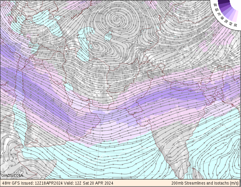
IT can be seen in this Jet Stream map


Analysis of the present amounts of Dust-

Above- Satellite imagery showing widespread dust over Pakistan!
Courtesy- MODIS

The above imagery clearly shows the dust plume lying in the North Arabian Sea. As seen from the image, there exsists a High pressure system somewhere over Iraq and a low pressure prevailing over the Arabian Sea has boosted the Shamal winds. A powerful jet and mid atmospheric winds have started bringing the dust towards India also.

RingRoad Weather Station's Weather Forecaster,Ashokbhai Patel reported today morning about the Hazy conditions in Gujarat. This news is a confirmed one as the Ahmedabad's weather station parameters confirm it.

Right now, conditions are much relaxed in the Gulf countries,Oman. However the satellite imagery shows some dust spread over Saudi Arabia southern end ( marked in red circle as DUST PLUMES)
The persisting winds shall be sending the dust more towards Sindh area and India especially Gujarat area.

I don't forsee any other parameter which can trigger another sandstorm in Gulf countries and Oman today

FORECAST-


WIDESPREAD DUST,BLOWING SAND WILL CONTINUE IN PAKISTAN,GUJARAT FOR THE NEXT 24 HRS ATLEAST.
* WIDESPREAD VISIBILITY PROBLEMS POSSIBLE IN THESE REGIONS***


*** DRIVERS ARE REQUESTED TO MONITOR THE CONDITIONS CAREFULLY***


THE OTHER STATES OF INDIA WILL NOT BE AFFECTED. HOWEVER SOME DUST MAY REACH PARTS OF NORTH INDIA

Monday, March 19, 2012

Into the Shamal Duststorm of Gulf countries which has engulfed the areas!

METD WEATHER
Akshay Deoras
Severe Weather Forecaster

MAJOR DUST-STORM HITS SAUDI CITIES,KUWAIT CITY,OMAN AND OTHER GULF COUNTRIES


Though the Dust-Storms are common in the Gulf States, a major dust-storm hit parts of Saudi Arabia,Kuwait,Oman,Gulf Countries like UAE and Yemen. Flight delays have been reported in Yemen.
Poor visibility conditions are being reported from UAE,Oman. In Sindh area also poor visibility and widespread dust is being reported.

Below are the photos of today afternoon from Muscat sent by METD WEATHER's Fan Mon Soon.
One can clearly see the dust in the two images.


More photos from UAE can be seen here-

The necessary conditions (discussed below) came together which triggered a dust storm. The passage of cold front across Saudi Arabia, Oman has caused the temperatures to come down significantly.


The 1430z satellite imagery clearly shows dust feature in Saudi Arabia and South-West of it. Flaring convection is seen at the lower left of the image indicating some presence of a low pressure area

WARNING AND FORECAST:


* THE TYPICAL PERIOD OF A SHAMAL SANDSTORM IS 3-5 DAYS. * HOWEVER CONDITIONS ARE NOW DECREASING FOR ANOTHER MAJOR ONE 
*HOWEVER PEOPLE ARE REQUESTED TO FOLLOW THE LOCAL WEATHER AND GOVERNMENT OFFICIALS. 
*THE ROYAL OMAN POLICE HAS WARNED PEOPLE OF OMAN TO TAKE PRECAUTIONS TILL THIS WEDNESDAY


What are such dust-storms???

Dust-storms often referred as Sandstorms are a natural phenomena occurring in the arid,desert regions where there are persisting conditions for synoptic lifting of sand i.e having a significant source of sand in the vicinity. The primary condition required for a sandstorm is the presence of a large area of sand. An image posted below shows the Dust source areas which are widely observed in Iraq.


Below shows the Major Dust producing Regions where there is a significant region in Iraq,Saudi Arabia


Courtesy- Air Force Weather Agency/NRL,USGC and COMET education programe.

The Next prominent thing required depends on the type of the dust-storm. There are two types
1) The Haboob
2) Shamal type

We shall not consider much details about the Haboob type as the recent sand-storm is of the Shamal Type.In the Haboob type, the outflow of a thunderstorm is responsible for triggering the sand-storm.
The thunderstorms have an outflow boundary and hence an ouflow where the winds are moving out of the system as the thunderstorms move. The gust front or the leading edge of air of a thunderstorm then carries dust with it. In a similar way, downbursts also trigger the storms. Downburst happens when the downdraft (coloumn of air coming down from thunderstorm) appears suddenly.
File:Haboob Ransom Canyon Texas 2009.jpg
Example of Haboob-

The another type is Shamal type of a dust storm!

In a Shamal type, the dust storm is created due to a perfect combination of air pressures and air fronts.
In a Shamal type, an airfront (mostly cold front) where a cold front is a leading edge of a cool air mass carries dust with it.

What is a Shamal??
Its a local name given to the North-Westerly winds blowing at lower levels of the atmosphere over areas like Iraq,Saudi Arabia,Kuwait etc. As a North-Westerly wind setup is responsible for this type of dust-storm, its named as Shamal dust storm.

Mechanism-

We shall now see how a Shamal type of dust storm or pre-frontal dust storm is set up!
The most important ingredient required is a Low Pressure area over Iran or vicinity. Low pressure area forms when the air in the region rises up in the atmosphere reducing the overall air density and hence pressure in the region. Occasional low pressures form in the areas like Iran at the 500mb or mid atmosphere level.
As seen from the below map, the areas north of Syria etc have higher elevation. When the Shamal winds blow, they carry cool air from that region towards warmer region or warmer air of areas like Saudi Arabia etc. Thus the leading edge of this air mass is what we call as the cold front denoted by the black line with triangles over Oman region . Since the below region shows the Shamal sandstorm at an age of 3-4 days i.e 3-4 days after its birth.

In the below image, just below L 500mb in Iran you can see white dashed lines. The white dashed lines are called as troughs which are nothing but imaginary lines which can be drawn which connects low pressure regions. This trough feature is easily noted in the upper level maps

File:Shamal1 en.jpg


Above-  IMG 2
The upper atmospheric map shows the trough feature over Iran. Its an amplified trough (shown by a bit purple region)

Image Courtesy-

THE COMET PROGRAME

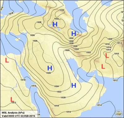
 Surface map depicting prefrontal winds over the Middle East

There is also a jet stream factor (jetstreams are the currents of air at higher altitude of over 30,000 ft which are flowing throughout the world from west to east direction ). Whenever a polar jet stream digs more southward near Iraq or Syria area it comes much closer to the subtropical jet stream which presence is shown in the upper atmospheric map i.e IMG 2. Due to this, there is a interaction between the two jets which amplify a part of the cold front as seen below
Schematic of synoptic conditions for a prefrontal dust storm


In the above image, the blue line is a cold front heading in the direction where the triangle is pointing, it can be seen that the surface max winds are amplified and hence much more sand can be lifted in such a case. Also due to this arrangement lifting of sand is enhanced.

Thus all the conditions are together for a perfect shamal sandstorm.

Associated dust area-

Depending on the cold front movement, the dust area is divided into two parts-
Pre-frontal area and post frontal area.
A pre-frontal area is that area from where the cold front is yet to pass and post frontal is that area over which the cold front has already passed.

Surface analysis depicting fronts and blowing dust over the Middle East
Here,
the red lines are warm front which is opposite to the blue cold front!


What to do during a dust-storm

Check this link
http://www.wikihow.com/Survive-a-Dust-Storm-or-Sandstorm